
This post follows on from: Tierra Del Fuego and Cape Horn
Patagonia
Patagonia is one of those mystery places: we know the name but we don’t really know much about it or where it actually is.
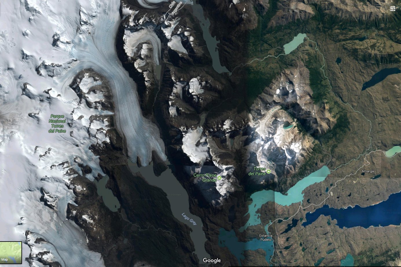
Patagonia isn’t a country but a region on the southern tip of South America. It is large – a little bigger than South Australia – and straddles the southern parts of Chile and Argentina. With an area of around 1 million square kilometres it covers about 30% of the two countries with 10% located in Chile and 90% in Argentina. There is, however, no political link between the two sub-Patagonian regions. The region itself is not precisely defined, in particular, there is some differing opinions about where the northern border lies and whether or not Tierra del Fuego is part of Patagonia. The following map – which shows the various stages of our travels – highlights the general Patagonian region and the border between Chile and Argentina.
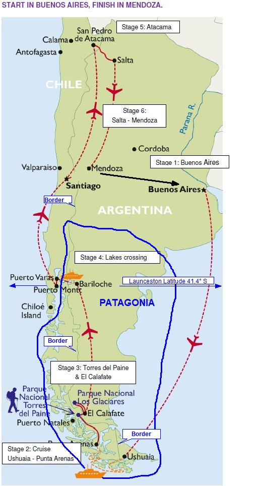
Puerto Montt and Bariloche, two places we would see on our trip, are around the same latitude as Launceston at around 410 South. Ushuaia is at latitude 550 South, the same as Macquarie Island, making it well south of Hobart at 430. Given its very southerly location, the population of Patagonia is surprisingly large, at around 2 million. We didn’t encounter much in the way of hideous weather and the countryside was somewhat different to the freezing barrenness we had expected. It matched Australia in many ways, with long distances between settlements while not giving the impression of total isolation and desolation. We were surprised to find a number of sizeable, thriving and bustling towns.
Torres del Paine National Park
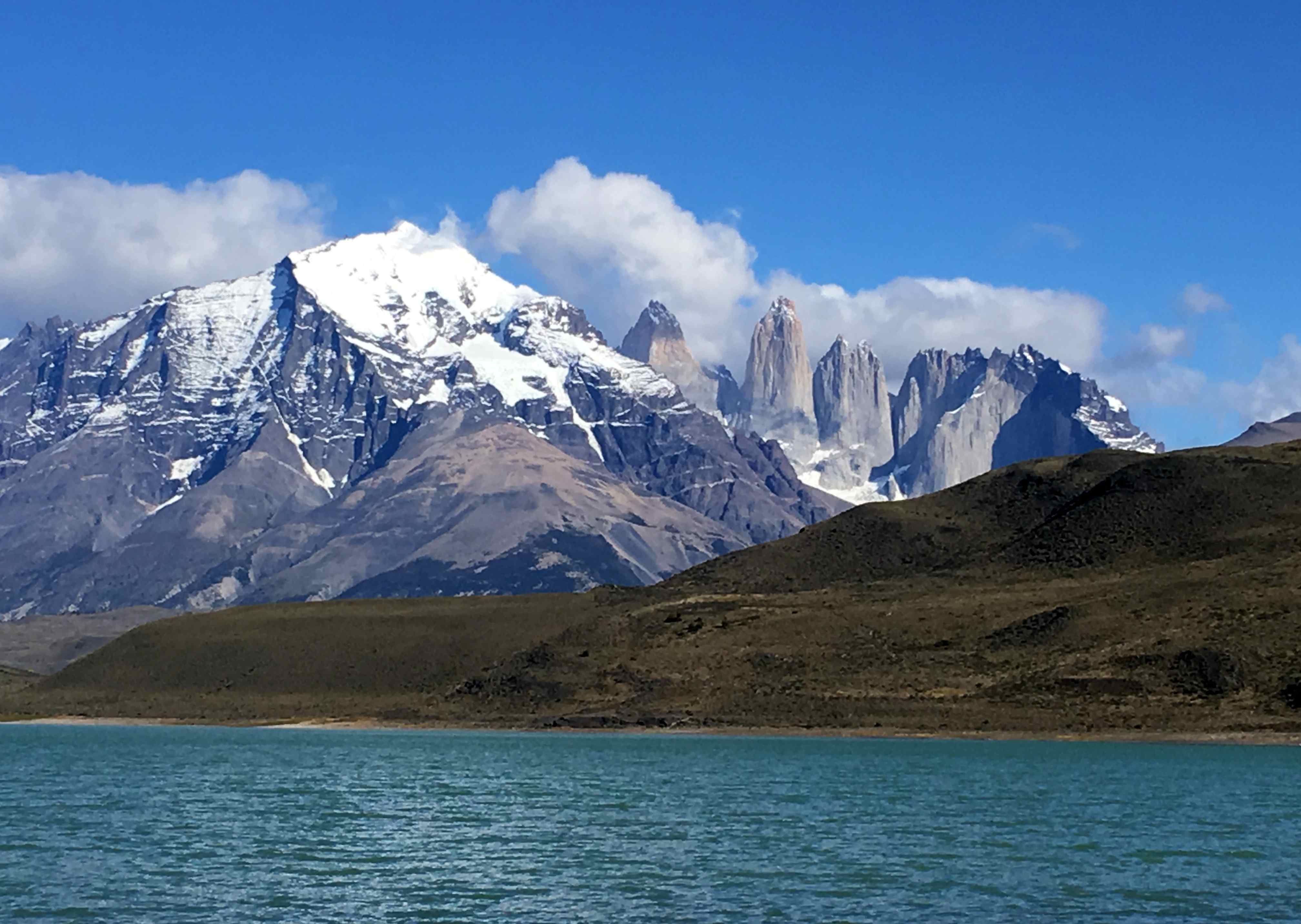
The Torres del Paine National Park is located in Chile, though it edges the border of Argentina. The really famous part of the park – the massif where the three towers are located – seems to stand alone on the eastern side of the Andes as a “lump”, rising from the landscape. The lakes at its base are barely 40 metres above sea level.
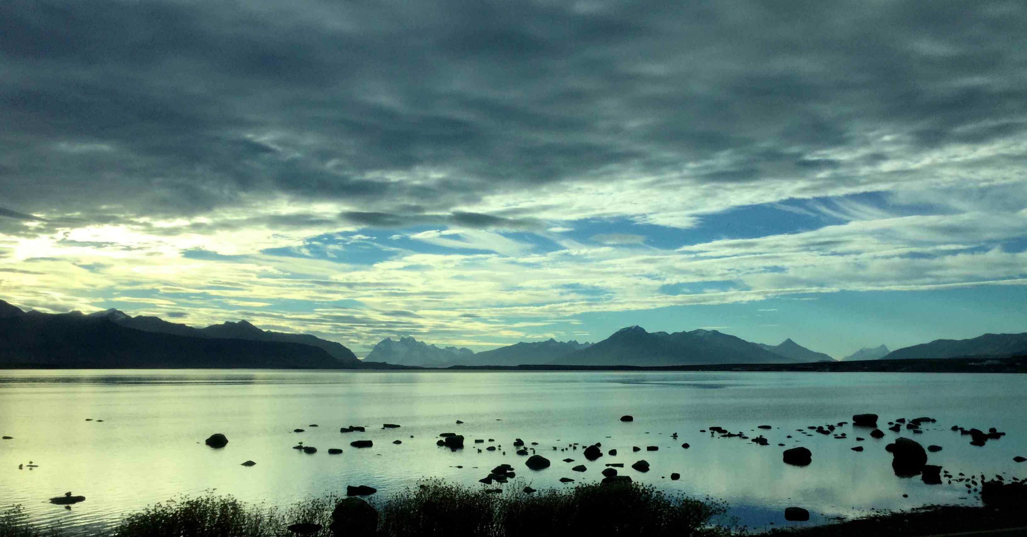
The features of the park overall are clearly seen in the Google satellite map below. To the west lie the snow-capped Andes. The tongue of the Grey Glacier heading south-eastwards is clearly seen, as is the massif where the three towers are located. To the east lies the Patagonian Steppe also known as the Patagonian Desert, one of the largest deserts in the world, albeit a cool climate one, stretching away towards the Atlantic Ocean; the dryness of the landscape is quite apparent.
The W-Trek
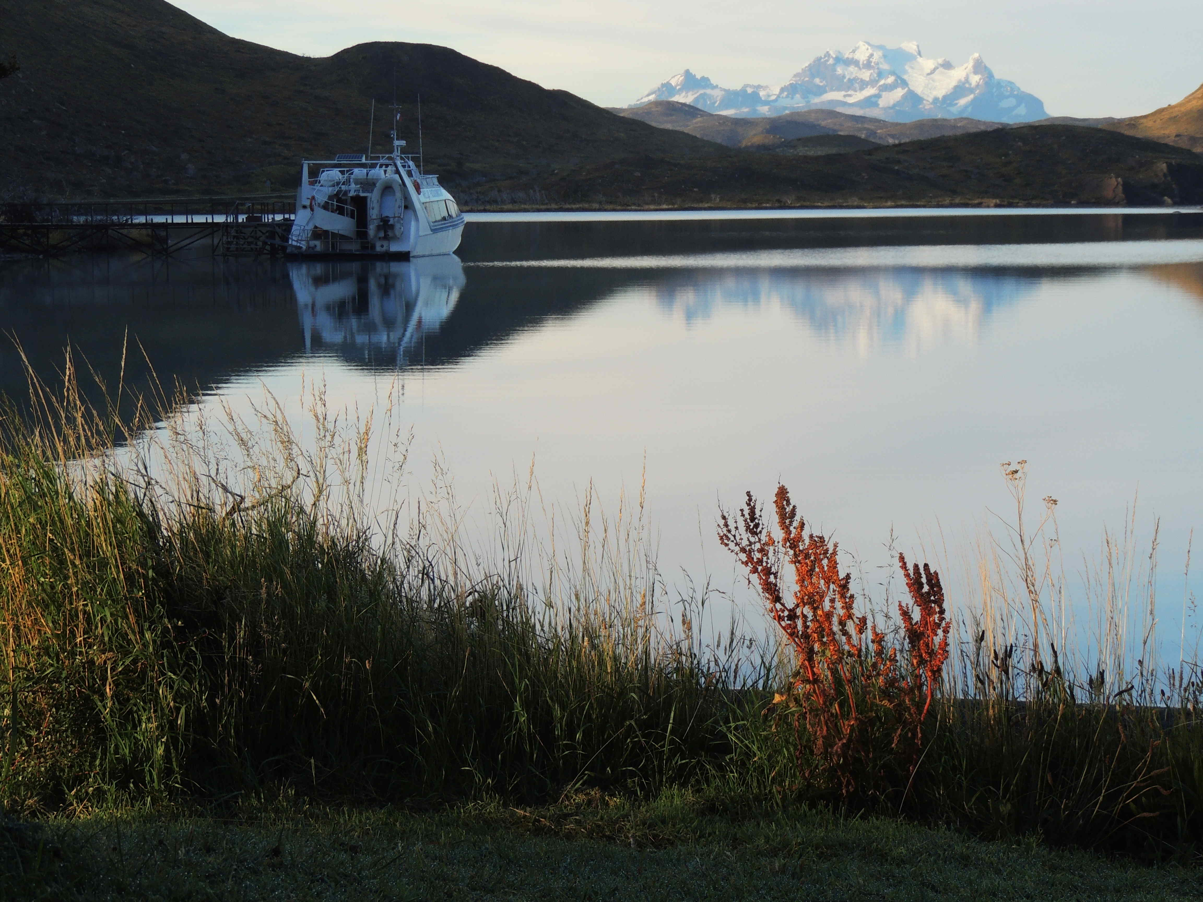
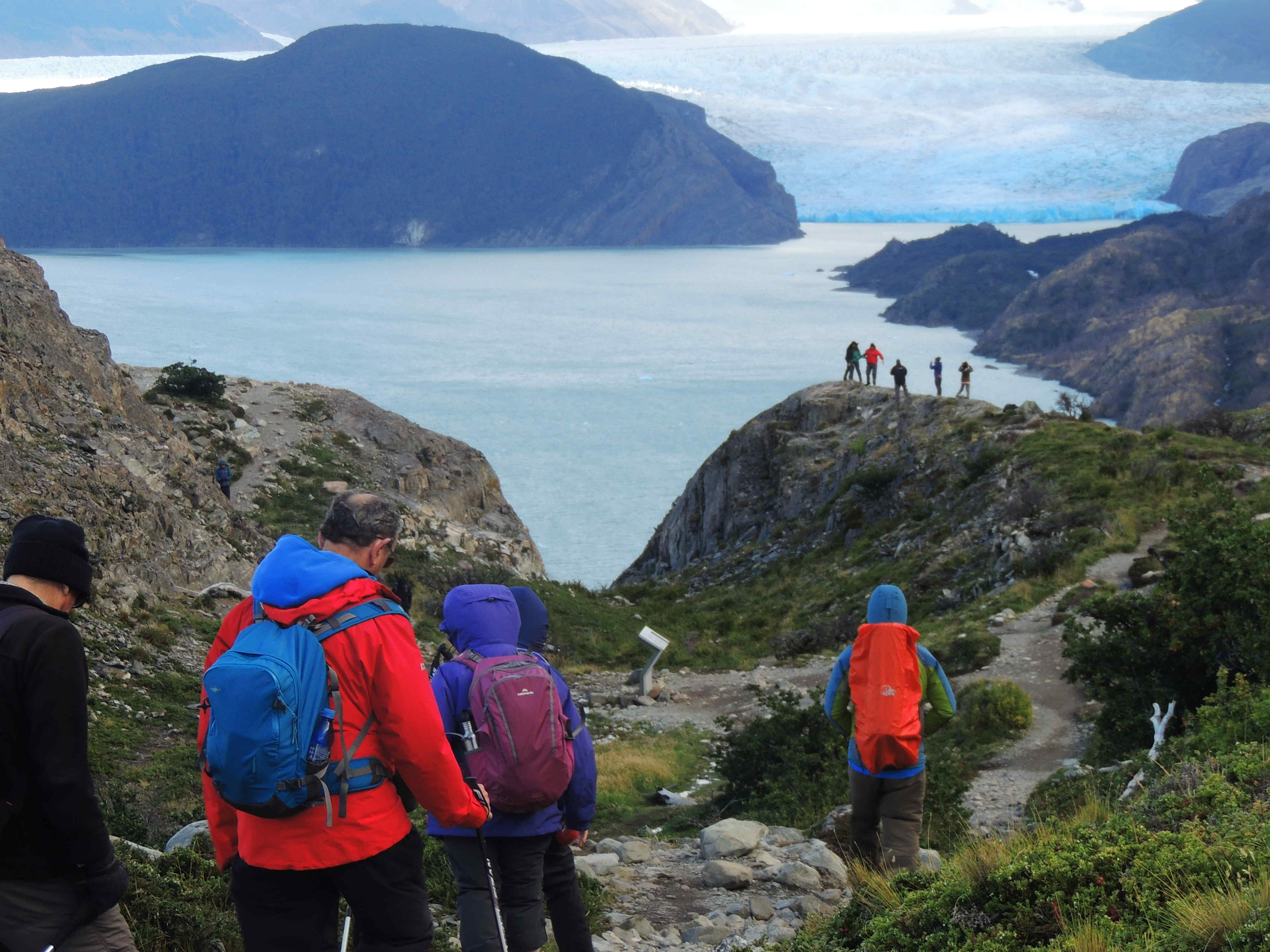
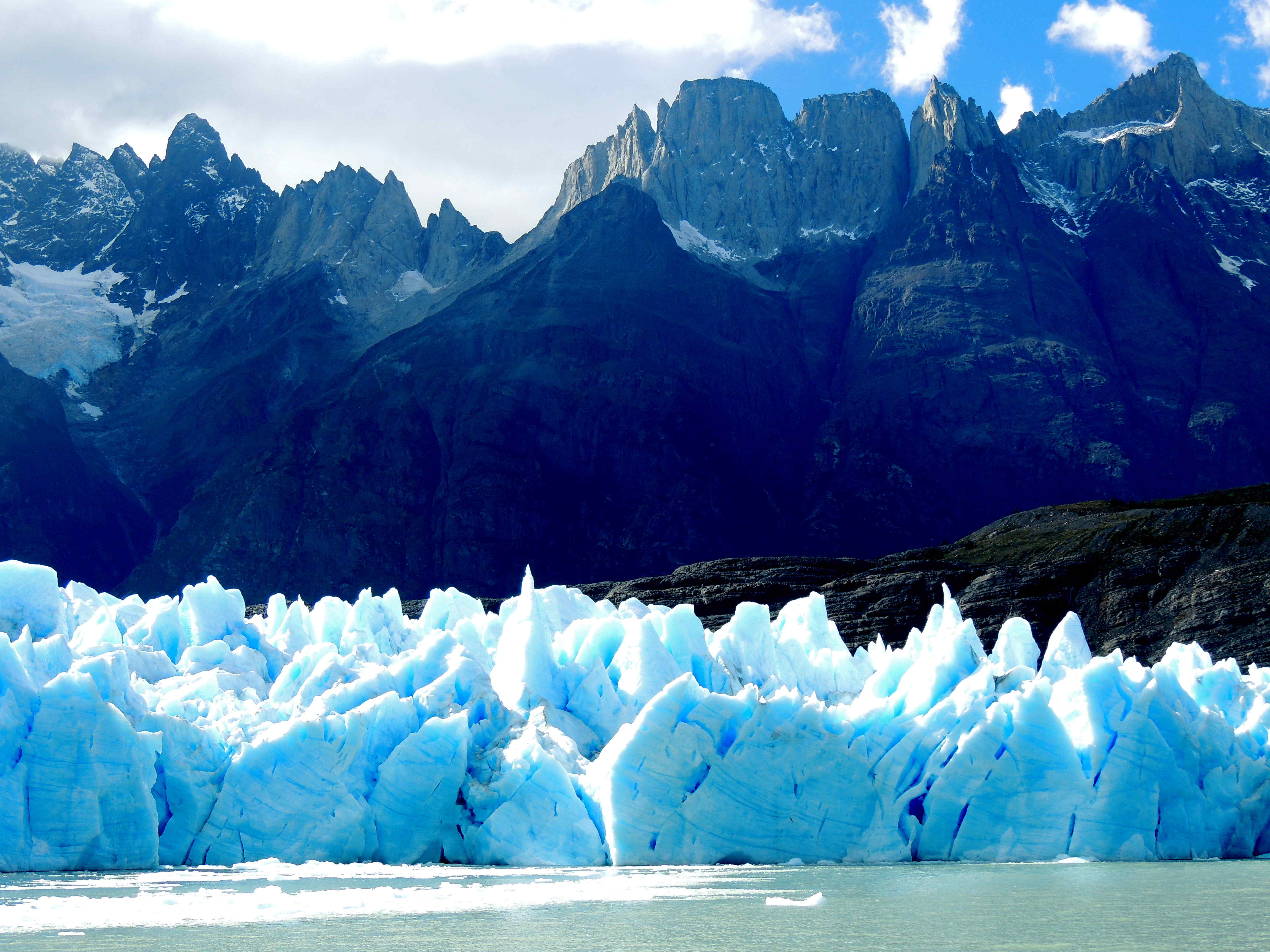
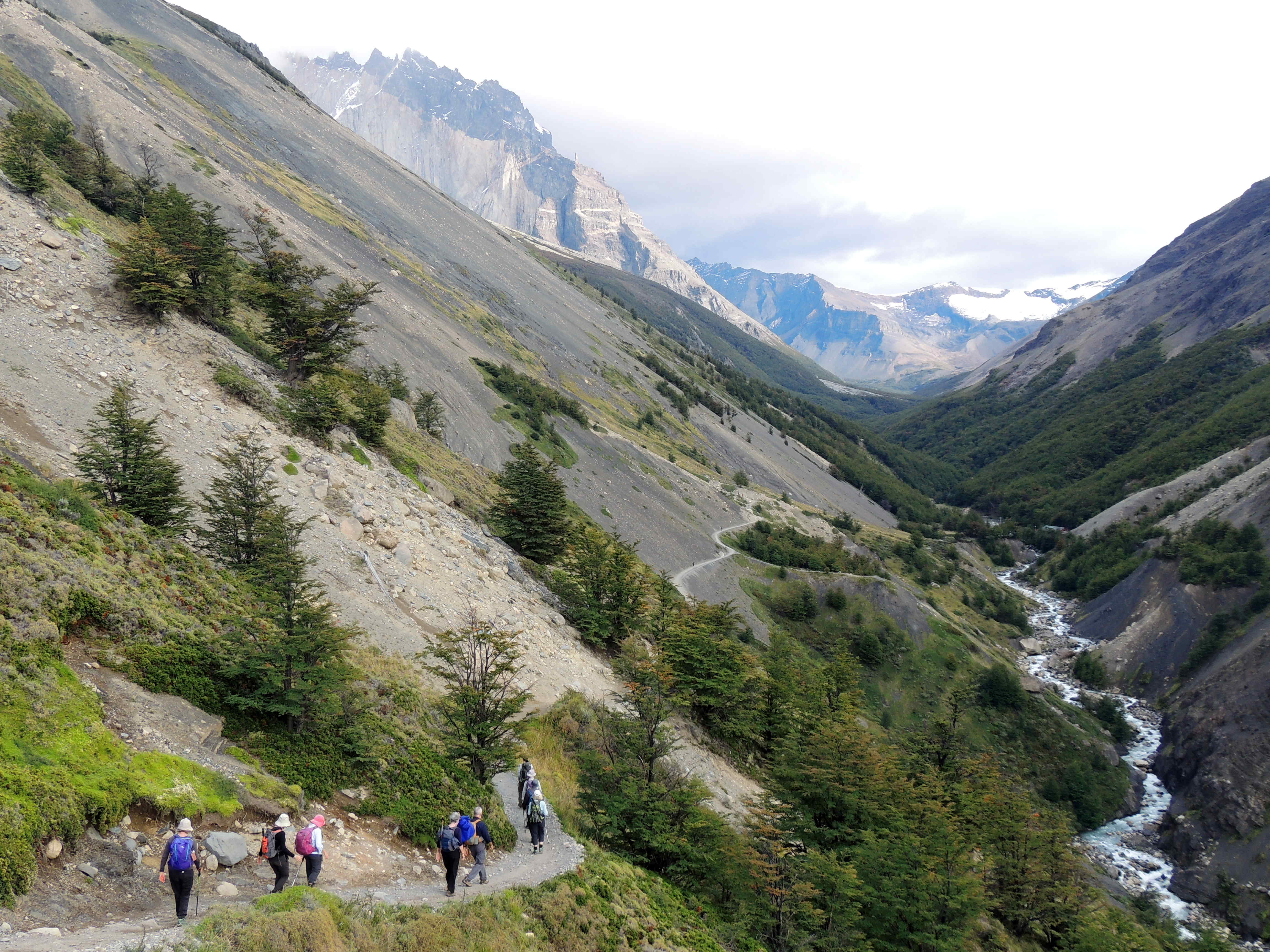
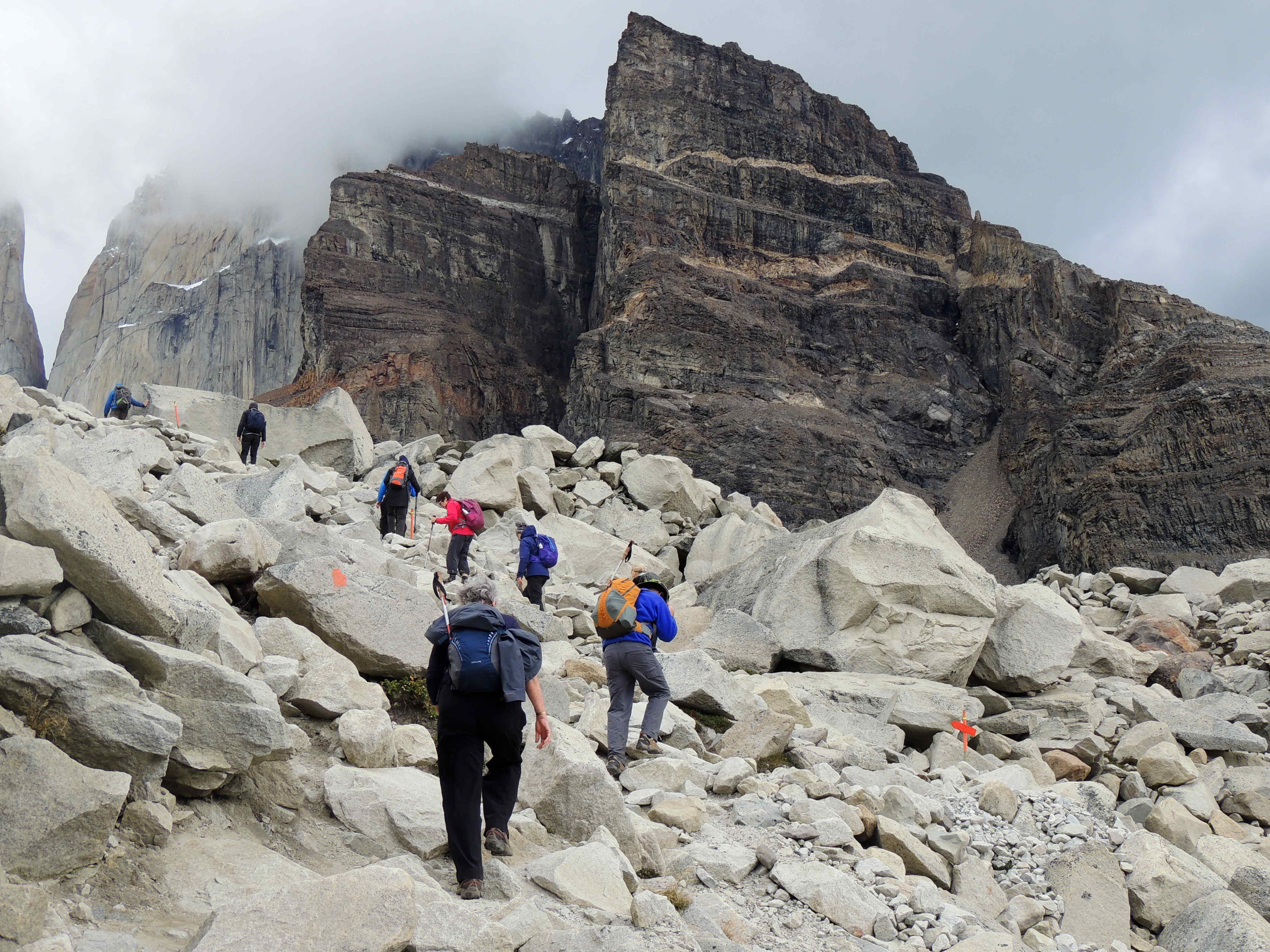
The national park has become an icon for keen bushwalkers (trekkers) from around the world. In particular, many want to complete the W-Trek. The trek can be completed over three to five days with a guide or self-guided. Our group of 16 is a tough lot and 12 were brave enough to set out to complete three days of the W-Trek. In the next photo they head towards Grey Glacier. And in the following one they get a close up look of the glacier from a boat on the lake.
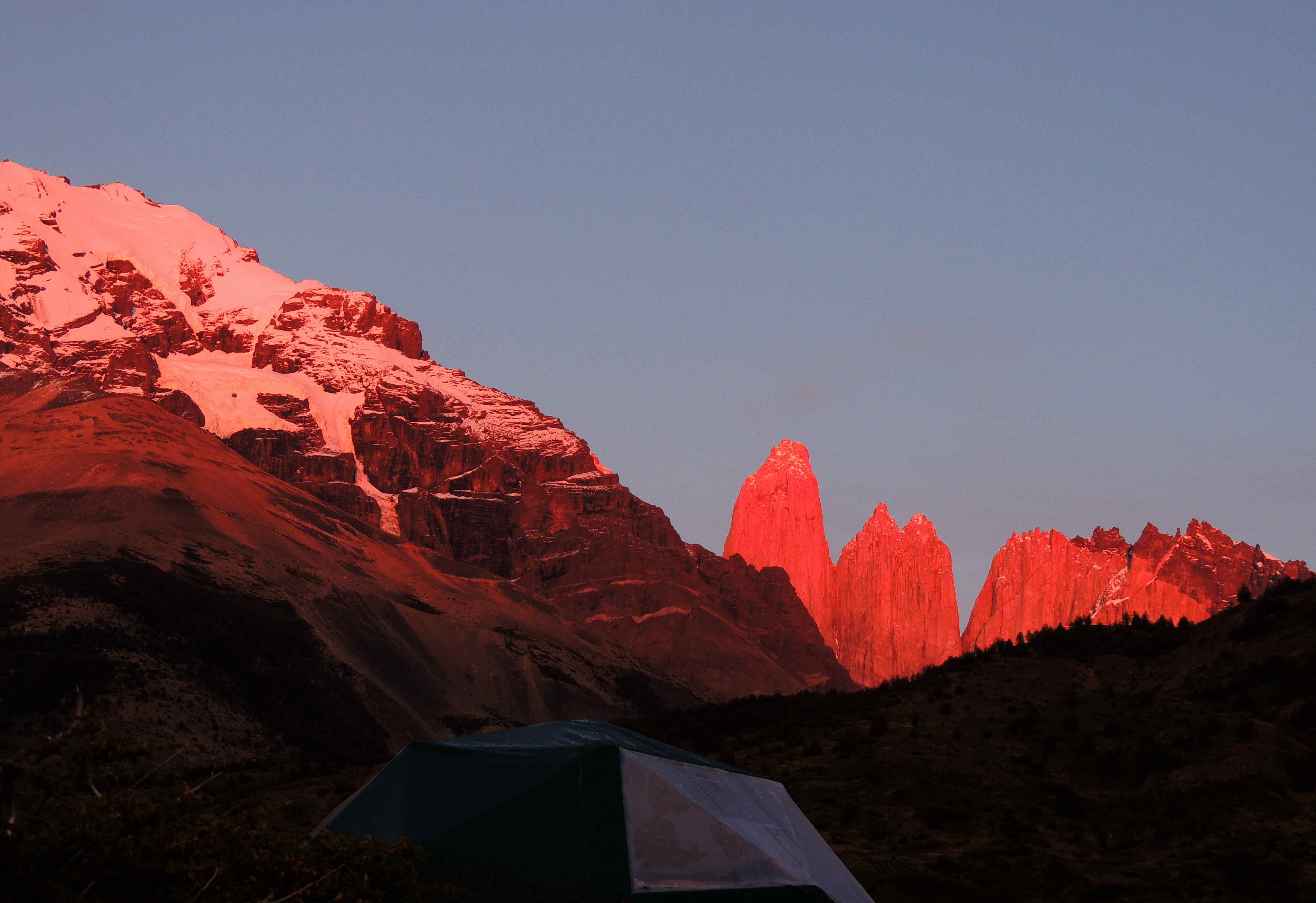
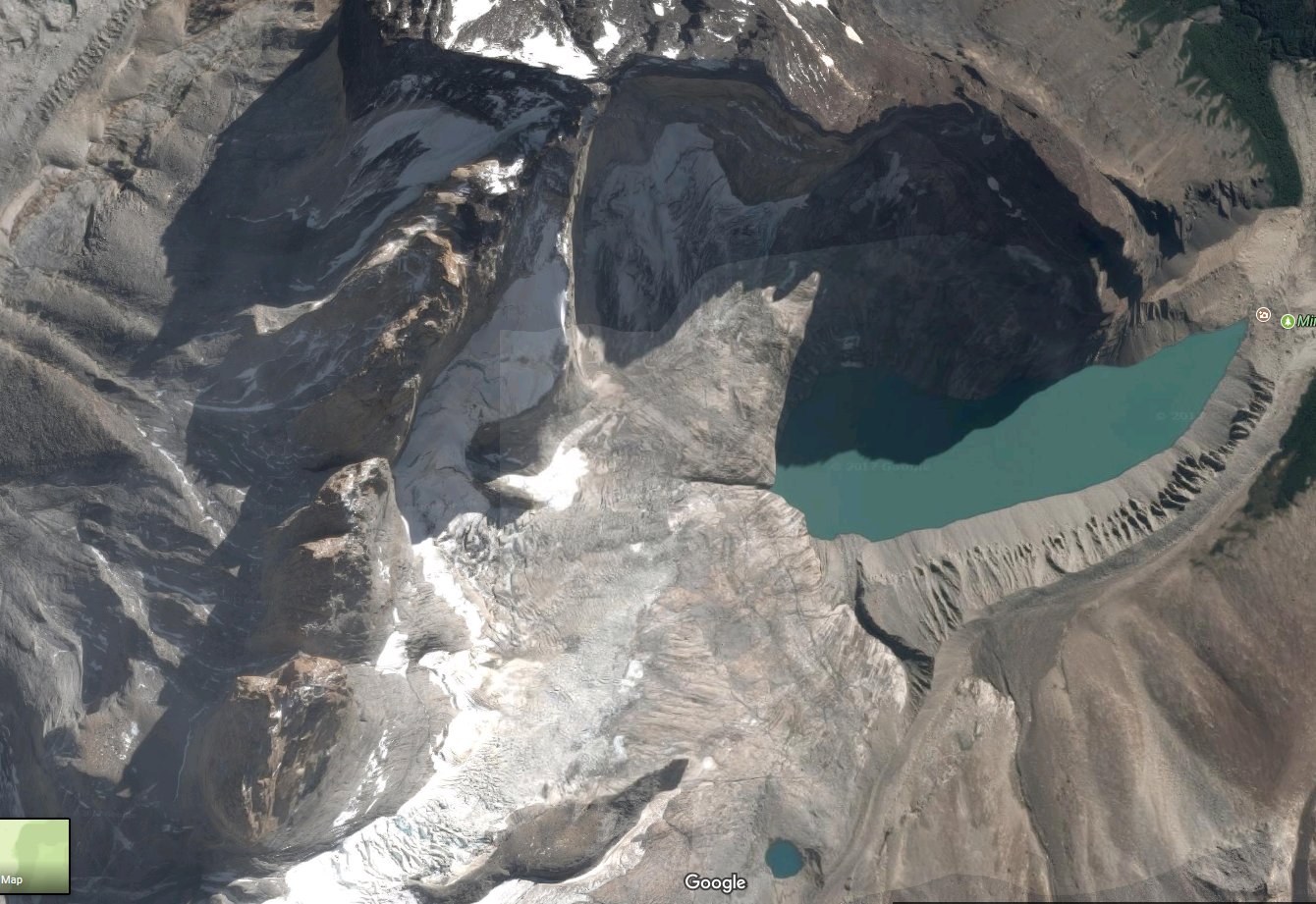
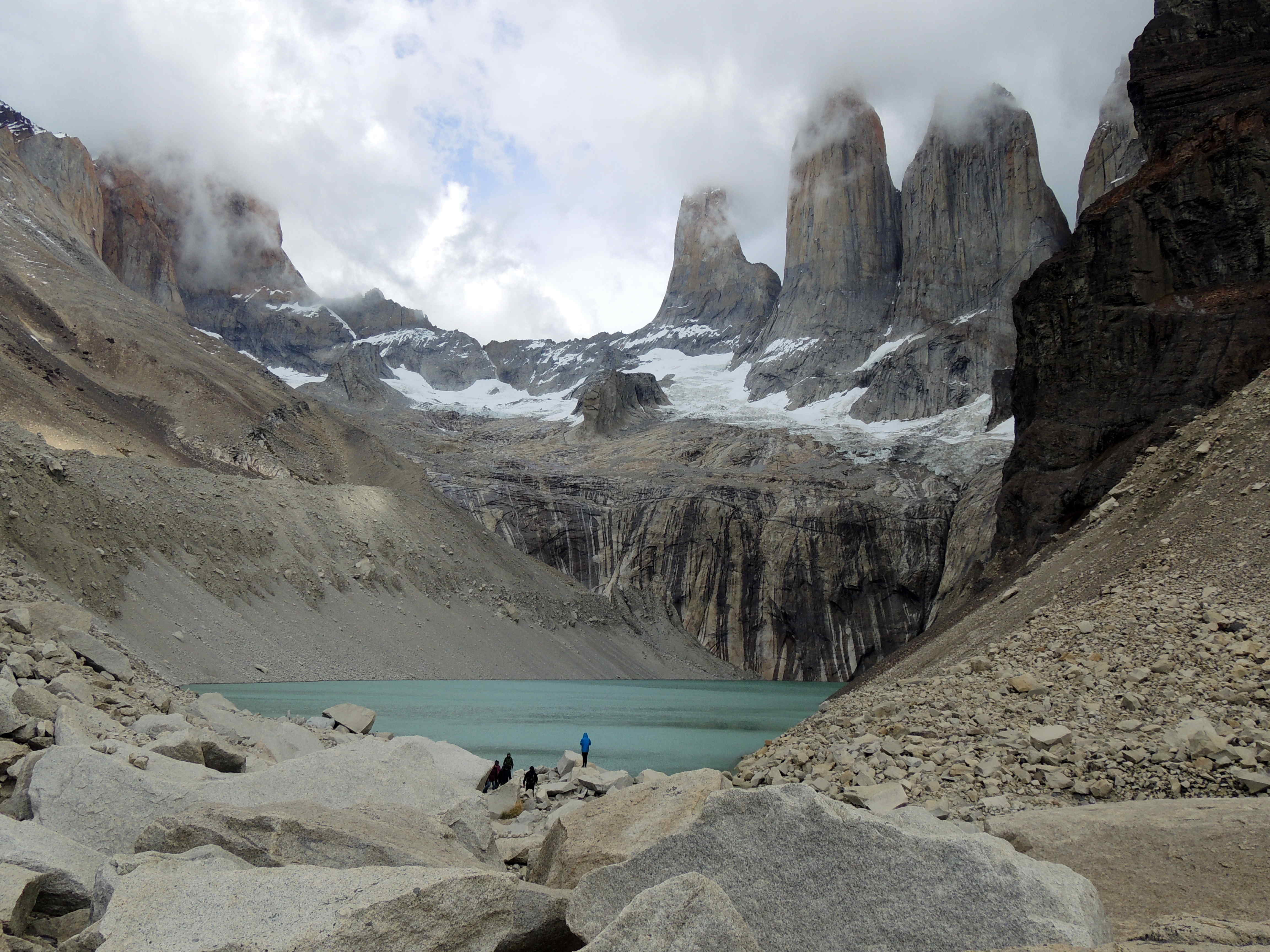
The real icon, however, are the three granite peaks, or towers (Torres), in the middle of the massif. The first photo below shows them in the distance early morning and the second from the edge of one of the lakes. The next is another Google map where the three towers are seen from above, to the left of the photo. The photos after that show parts of the trek route undertaken by our group, before reaching the lake at the base of the Torres.
Where to stay, where to eat?
Accommodation tends to be outside the park itself, in former farmland. There is a reasonable range of options: from very affordable backpacker hostels to luxury lodges. We were unfortunate enough to have chosen an expensive, upmarket property that failed to deliver its promise of remarkable accommodation and food. To add to our regret of wasted money, on our return to Australia, other friends told us about the property they stayed at some months earlier which was about one third of the price but offering and delivering just as much as ours, or more. Thus, if you intend to go to Torres del Paine do your research about where to stay and about the trekking options. The trekking route is easy to follow, so for many experienced walkers a guide is not essential.
Zucchini Carpaccio
Our over-hyped property generally failed to deliver any food or wine that was remarkable. In fact, only one stood out from their short menu of generally European based dishes – this very simple and delicious zucchini appetizer.

For four people you will need one or two medium to large zucchinis; large ones are fine and probably look more impressive. You might not use all you slice, but it is better to have more than not enough. You can have the slicing done earlier, but prepare the dish just before serving. Use large plates.
Wash and dry the zucchinis and pat dry. Using a mandolin or a very sharp knife, slice cross-wise into slices of 2 to 4 ml thickness.
Break a small clove of garlic in half and rub each plate lightly with the cut end.
Layer the zucchini slices over the whole plate. Drizzle with some lovely olive oil and lemon juice (two or three parts oil to the juice) and season with salt and cracked pepper.
Over each plate scatter around about a half a teaspoonful of capers in vinegar.
(Optional) Sprinkle or grate over a dash of palm sugar if the dressing is too lemony.
Equipment: Mandolin slicer or very sharp knife.
Difficulty: 1/5, Very Easy. Five to 10 minutes preparation.
Serve: Immediately after dressing. Serves 4 people as an appetiser.
—————————————————
Click here for the next stage in our South American journey: El Calafate!